| Andaman and Nicobar Islands |
| — Union Territory — |
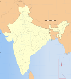 Location of Andaman and Nicobar Islands
|
|
| Coordinates |
 11°41'N 92°46'E? / ?11.68°N 92.77°E? / 11.68; 92.77 11°41'N 92°46'E? / ?11.68°N 92.77°E? / 11.68; 92.77 |
| Country |
 India India |
| Territory |
Andaman and Nicobar Islands |
| District(s) |
3 |
| Established |
1956-11-01 |
| Capital |
Port Blair |
| Largest city |
Port Blair |
| Lt. Governor |
Lieutenant General Bhopinder Singh |
Population
• Density
|
356,1521
• 43 /km2 (111 /sq mi)
|
| Official languages |
Hindi, Bengali, Tamil, English, Malayalam, Nicobarese |
| Time zone |
IST (UTC+5:30) |
| Area |
8250 km2 (3185 sq mi) |
| ISO 3166-2 |
IN-AN |
Population data as per the Indian Census
|
| Website |
www.and.nic.in// |
|
The Andaman and Nicobar Islands are a group of islands in the Indian Ocean and a Union Territory of The Republic of India.
The territory is located in the Indian Ocean, and geographically is considered part of Southeast Asia, close to Aceh in Indonesia and separated from them by the Andaman Sea. It comprises two island groups, the Andaman Islands and the Nicobar Islands, separated by the 10° N parallel, with the Andamans to the north of this latitude, and the Nicobars to the south. The Andaman Sea lies to the east and the Bay of Bengal to the west.
The territory's capital is the Andamanese town of Port Blair. The territory's population as per the most recent (2001) Census of India was 356,152. Added together, the total land area of the territory is approximately 6,496 km² or 2,508 sq mi.
History
The Andaman and Nicobar islands have been inhabited for several thousand years, at the very least. The earliest archaeological evidence yet documented goes back some 2,200 years; however, the indications from genetic, cultural and linguistic isolation studies point to habitation going back 30,000 to 60,000 years, well into the Middle Paleolithic.
In the Andaman Islands, the various Andamanese people maintained their separated existence through the vast majority of this time, diversifying into distinct linguistic, cultural and territorial groups. By the 1850s when they first came into sustained contact by outside groups, the indigenous people of the Andamans were:
- the Great Andamanese, who collectively represented at least 10 distinct sub-groups and languages;
- the Jarawa;
- the Jangil (or Rutland Jarawa);
- the Onge; and
- the Sentinelese (most isolated of all the groups).
In total, these people numbered somewhere around 7,000 at the time of these first encounters. As the numbers of settlers from the mainland increased (at first mostly prisoners and involuntary indentured labourers, later purposely recruited farmers), these indigenous people lost territory and numbers in the face of punitive expeditions by British troops, land encroachment and the effects of various epidemic diseases. The Jangil and most of the Great Andamanese groups soon became extinct; presently there remain only approximately 400–450 indigenous Andamanese, the Jarawa and Sentinelese in particular maintaining a steadfast independence and refusing most attempts at contact.
The indigenous people of the Nicobars (unrelated to the Andamanese) have a similarly isolated and lengthy association with the islands. There are two main groups: the Nicobarese, or Nicobari, living throughout many of the islands; and the Shompen, restricted to the hinterland of Great Nicobar.
Pre-colonial era
The islands provided a temporary maritime base for ships of the Marathas in the 17th century. The legendary admiral Kanhoji Angre established naval supremacy with a base in the islands.
British Colonial Period
After an initial attempt to set up a colony in the islands by the British was abandoned after only a few years (1789–1796), a second attempt from 1858 proved to be more permanent. The primary purpose was to set up a penal colony for dissenters and independence fighters from the Indian subcontinent.
The British used the islands as an isolated prison for members of the Indian independence movement. The mode of imprisonment was called Kala pani. The Cellular Jail in Port Blair was regarded as the "Siberia" of British India.
The islands were administered as a Chief Commissioner's Province.
The British continued their occupancy until the Japanese invasion and occupation of the Andaman Islands during World War II.
Indian Control
The islands were nominally put under the authority of the Arzi Hukumate Azad Hind of Netaji Subhash Chandra Bose. Netaji visited the islands during the war, and renamed them as "Shaheed" (Martyr) & "Swaraj" (Self-rule). General Loganathan, of the Indian National Army was made the Governor of the Andaman and Nicobar Islands. On 22 February 1944 he along with four INA officers-Major Mansoor Ali Alvi, Sub. Lt. Md. Iqbal, Lt. Suba Singh and stenographer Srinivasan arrived at Lambaline airport of Port Blair. On 21 March 1944 the Headquarters of the Civil Administration was established near the Gurudwara at Aberdeen Bazaar. On 2 October 1944, Col. Loganathan handed over the charge to Maj. Alvi and left Port Blair, never to return.. The islands were reoccupied by British and Indian troops of the 116 Indian Infantry Brigade on 7 October 1945, to whom the remaining Japanese garrison surrendered.
At the independence of both India (1947) and Burma (1948), the departing British announced their intention to resettle all Anglo-Indians and Anglo-Burmese on the islands to form their own nation, although this never materialized. It became an Indian union territory (UT) in 1950.
Recent history
On 26 December 2004 the coasts of the Andaman and Nicobar Islands were devastated by a 10 metres (33 ft) high tsunami following the 2004 Indian Ocean earthquake. At least 5,930 people were believed to have been killed on the Nicobar and Andaman Islands during the disaster. The worst affected Nicobar islands were Katchal and Indira Point, the latter the southernmost point of India, which was submerged by the ocean.
While newer settlers of the islands suffered the greatest casualties from the tsunami, most of the aboriginal people survived because oral traditions passed down from generations ago warned them to evacuate from large waves that follow large earthquakes.
Geography
There are 572 islands in the territory, of which only approximately 38 are permanently inhabited. Most of the islands (about 550) are in the Andamans group, 26 of which are inhabited. The smaller Nicobars comprise some 22 main islands (10 inhabited). The Andamans and Nicobars are separated by a channel (the Ten Degree Channel) some 150 km wide. The highest point is located in North Andaman Island (Saddle Peak at 732 metres (2,402 ft)).
The total area of the Andaman Islands is some 6,408 km2 (2,474 sq mi); that of the Nicobar Islands approximately 1,841 km2 (711 sq mi).
Flora
Andaman & Nicobar Islands are blessed with a unique tropical rainforest canopy, made of a mixed flora with elements from Indian, Myanmarese, Malaysian and endemic floral strains. So far, about 2,200 varieties of plants have been recorded, out of which 200 are endemic and 1,300 do not occur in mainland India.
The South Andaman forests have a profuse growth of epiphytic vegetation, mostly ferns and orchids. The Middle Andamans harbours mostly moist deciduous forests. North Andamans is characterised by the wet evergreen type, with plenty of woody climbers. The North Nicobar Islands (including Car Nicobar and Battimalv) are marked by the complete absence of evergreen forests, while such forests form the dominant vegetation in the central and southern islands of the Nicobar group. Grasslands occur only in the Nicobars, and while deciduous forests are common in the Andamans, they are almost absent in the Nicobars. The present forest coverage is claimed to be 86.2% of the total land area.
This atypical forest coverage is made-up of twelve types namely:
- Giant evergreen forest
- Andamans tropical evergreen forest
- Southern hilltop tropical evergreen forest
- Cane brakes
- Wet bamboo brakes
- Andamans semi-evergreen forest
- Andamans moist deciduous forest
- Andamans secondary moist deciduous forest
- Littoral forest
- Mangrove forest
- Brackish water mixed forest
- Submontane hill valley swamp forest
Timber
Andaman Forest abounds in a plethora of timber species numbering 200 or more, out of which about 30 varieties are considered to be commercial. Major commercial timber species are Gurjan (Dipterocarpus spp.) and Padauk (Pterocarpus dalbergioides). The following ornamental woods are noted for their pronounced grain formation:
- Marble Wood (Diospyros marmorata)
- Padauk (Pterocarpus dalbergioides)
- Silver Grey (a special formation of wood in white chuglam)
- Chooi (Sageraea elliptical)
- Kokko (Albizzia lebbeck)
Padauk being sturdier than teak is widely used for furniture making.
There are burr wood and buttress formations in Andaman Padauk. The largest piece of buttress known from Andaman was a dining table of 13' x 7'. The largest piece of burr was again a dining table to seat eight persons at a time.
The holy Rudraksha (Elaeocarps sphaericus) and aromatic Dhoop/Resin trees also are found here.
Fauna
These islands because some like turbo, trochus & nautilus etc. are used as novelties supporting many cottage industries producing a wide range of decorative items & ornaments. Shells such as giant clam, green mussel and oyster support edible shellfishery, a few like scallop, clam, and cockle are burnt in kilns to produce edible lime.
Demographics
The major languages spoken in the Andamans in numerical order are Bengali (25.95%), Hindi (18.4%), Urdu (14.2%), Tamil including Sri Lankan Tamils (17.84%), Nicobarese and Telugu (12.93%). Other languages include Malayalam and English. The majority of Andamans are Hindus, with significant Muslim, Christian and Sikh minorities.
Foreigners wishing to visit the Andaman and Nicobar Islands require a Restricted Area Permit; however, they are now available on arrival at Port Blair's Veer Savarkar Airport.
Government
Andaman & Nicobar Islands are divided into 3 administrative districts. Each district is further divided into Sub-Divisions and taluks.
South Andaman district
Headquarters: Port Blair
Sub-Divisions & Taluks:
- Port Blair Sub-Division
- Port Blair taluk
- Ferrargunj taluk
- Little Andaman Sub-Division
- Little Andaman taluka (Hut Bay)
Nicobar District
Headquarters: Car Nicobar
Sub-Divisions & Taluks:
- Nancowrie Sub-Division
- Nancowrie taluk
- Kamorta taluk
- Teressa taluk
- Katchal taluk
- Great Nicobar Sub-Division
- Great Nicobar taluk (Campbell Bay)
- Little Nicobar taluk
Economy
Agriculture
A total of 48,675 hectares of land is used for agriculture purposes. Paddy, the main food crop, is mostly cultivated in Andaman group of islands, whereas coconut and areca nut are the cash crops of Nicobar group of islands. Field crops, namely, pulses, oilseeds and vegetables are grown, followed by paddy during Rabi season. Different kinds of fruits such as mango, sapota, orange, banana, papaya, pineapple and root crops are grown on hilly land owned by farmers. Spices, viz., pepper, clove, nutmeg, and cinnamon are grown under multi-tier cropping system. Rubber, red oil, palm and cashew are grown on a limited scale in these islands.
Industry
There are 1,374 registered small scale, village and handicrafts units. Two units are export oriented in the line of fish processing activity. Apart from this, there are shell and wood based handicraft units. There are also four medium sized industrial units. SSI units are engaged in the production of polythene bags, PVC conduit pipes and fittings, paints and varnished, fibre glass and mini flour mills, soft drinks and beverages, etc. Small scale and handicraft units are also engaged in shell crafts, bakery products, rice milling, furniture making , etc. The Andaman and Nicobar Islands Integrated Development Corporation has spread its wings in the field of tourism, fisheries, industries and industrial financing and functions as authorised agents for Alliance Air/Jet Airways.
Macro-economic Trend
This is a chart of trend of gross state domestic product of Andaman and Nicobar Islands at market prices estimated by Ministry of Statistics and Programme Implementation with figures in millions of Indian Rupees.
| Year | Gross State Domestic Product |
| 1980 |
530 |
| 1985 |
1,060 |
| 1990 |
1,900 |
| 1995 |
6,750 |
| 2000 |
9,560 |
| 2005 |
13,130 |
Andaman and Nicobar Islands' gross state domestic product for 2004 is estimated at $354 million in current prices.
External links